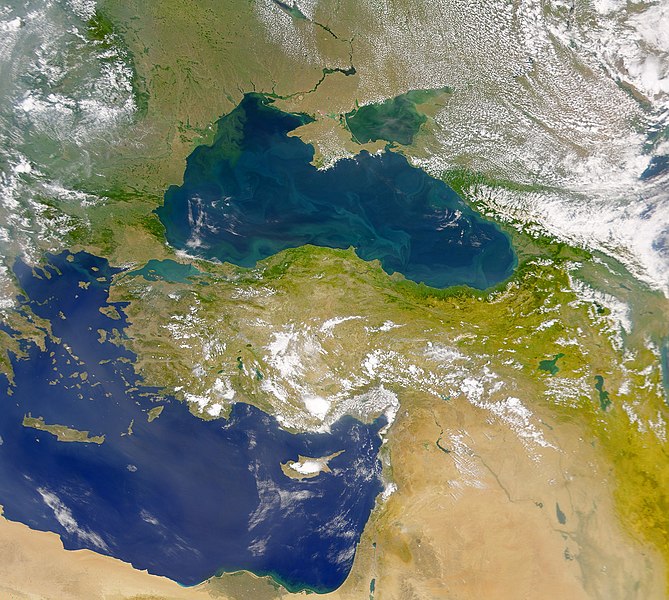
File:The Danube Spills into the Black Sea.jpg

本预览个尺寸:669×600像素。 其他分辨率:268×240像素 | 535×480像素 | 857×768像素 | 1,142×1,024像素 | 2,080×1,865像素。
原始文件 (2,080×1,865像素,文件大小:1.07 MB,MIME类型:image/jpeg)
文件历史
揿一个日脚/辰光来望当时出现过个文件。
| 日脚 / 辰光 | 微缩图 | 维度 | 用户 | 备注 | |
|---|---|---|---|---|---|
| 当前 | 2010年4月20号 (两) 19:20 |  | 2,080 × 1,865(1.07 MB) | Originalwana | {{Information |Description={{en|1=This cloud-free Sea-viewing Wide Field-of-view Sensor (SeaWiFS) view of the Black Sea reveals the colourful interplay of currents on the lake’s surface. The green crescent shaped pattern in the north-western cor |
文件用法
下向许1张用着箇文件:
全域文件用场
下底个其他wiki使用箇只文件:
- ady.wikipedia.org上个用途
- crh.wikipedia.org上个用途
- en.wikipedia.org上个用途
- eo.wikipedia.org上个用途
- fr.wikipedia.org上个用途
- gu.wikipedia.org上个用途
- hak.wikipedia.org上个用途
- hr.wikipedia.org上个用途
- hu.wikipedia.org上个用途
- ilo.wikipedia.org上个用途
- ja.wikipedia.org上个用途
- kn.wikipedia.org上个用途
- lg.wikipedia.org上个用途
- pl.wikipedia.org上个用途
- rm.wikipedia.org上个用途
- sr.wikipedia.org上个用途
- ta.wikipedia.org上个用途
- uk.wikipedia.org上个用途
- vi.wikipedia.org上个用途
- zh.wikipedia.org上个用途

