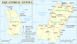
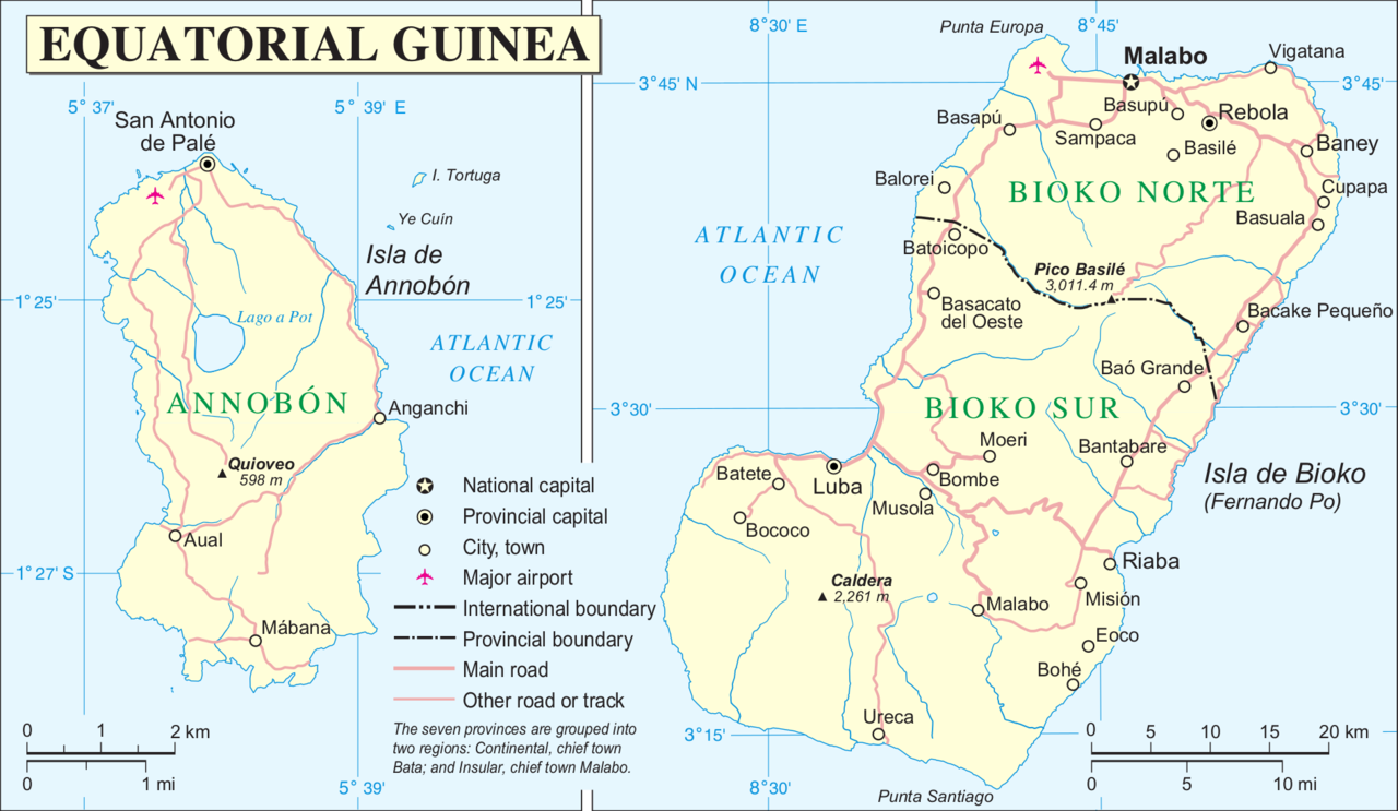
File:Annobón Bioko.PNG

原始文件 (1,894×1,100像素,文件大小:502 KB,MIME类型:image/png)
小结
| 描述 | |
| 日脚 | |
| 来源 | http://www.un.org/Depts/Cartographic/map/profile/eqguinea.pdf |
| 作者 | |
| 其他版本 |
此文件衍生的作品: |
授权协议
| This image is a map derived from a United Nations map.
Unless stated otherwise, UN maps are to be considered in the public domain. This applies worldwide. UN maps are, in principle, open source material and you can use them in your work or for making your own map. UN requests however that you delete the UN name, logo and reference number upon any modification to the map. Content of your map will be your responsibility. You can state in your publication, if you wish, something like: based on UN map … (map name, map number, revision number and date). See: Geospatial Information Section. And: Geospatial, location data for a better world. |
 |
文件历史
揿一个日脚/辰光来望当时出现过个文件。
| 日脚 / 辰光 | 微缩图 | 维度 | 用户 | 备注 | |
|---|---|---|---|---|---|
| 当前 | 2016年6月16号 (四) 03:12 | | 1,894 × 1,100(502 KB) | W like wiki | + lower margin |
| 2016年6月16号 (四) 01:26 |  | 1,895 × 1,098(501 KB) | W like wiki | Now all coordinates are more clear: E for EAST, N for NORTH, S for SOUTH !!! | |
| 2016年6月16号 (四) 01:04 |  | 1,895 × 1,098(500 KB) | W like wiki | link=|55px Even though the source of this file is the UN, the lower latitude coordinates of Annobón (located on the southern hemisphere!) seems to be '''wrong''', so '''1°27′''' is now used instead of '''1°23... | |
| 2014年9月7号 (日) 19:05 |  | 1,895 × 1,098(499 KB) | Basquetteur | Corrected to amend wrong spelling of Bioko (Isla de Boiko in original UN map) and also uploading a higher resolution version | |
| 2005年5月20号 (五) 11:47 |  | 946 × 553(88 KB) | Taichi | Mapa de Annobón y Bioko. Guinea Ecuatorial {{PD}} Fuente: http://www.un.org/Depts/Cartographic/map/profile/eqguinea.pdf |
文件用法
下向许1张用着箇文件:
全域文件用场
下底个其他wiki使用箇只文件:
- an.wikipedia.org上个用途
- azb.wikipedia.org上个用途
- de.wikipedia.org上个用途
- en.wikipedia.org上个用途
- eo.wikipedia.org上个用途
- es.wikipedia.org上个用途
- et.wikipedia.org上个用途
- fr.wikipedia.org上个用途
- gl.wikipedia.org上个用途
- it.wikipedia.org上个用途
- ja.wikipedia.org上个用途
- ko.wikipedia.org上个用途
- ml.wikipedia.org上个用途
- pl.wikipedia.org上个用途
- pt.wikipedia.org上个用途
- ru.wikipedia.org上个用途
- sco.wikipedia.org上个用途
- sh.wikipedia.org上个用途
- uk.wikipedia.org上个用途
- ur.wikipedia.org上个用途
- vi.wikipedia.org上个用途
- zh.wikipedia.org上个用途
- zu.wikipedia.org上个用途