File:Malaysia states named.png

本预览个尺寸:800×274像素。 其他分辨率:320×109像素 | 640×219像素 | 1,500×513像素。
原始文件 (1,500×513像素,文件大小:163 KB,MIME类型:image/png)

|
此map图片可使用矢量图形重新创建为SVG文件。这具有很多好处;更多信息请参见共享资源:待清理媒体。如果存在此图片的SVG格式,请将其上传,然后将此模板替换为
{{vector version available|新图片名称}}。
建议您将SVG命名为“Malaysia states named.svg”,这样在使用Vector version available(或Vva)模板时就不需要填写新图片名称参数。 |
小结
| 描述 |
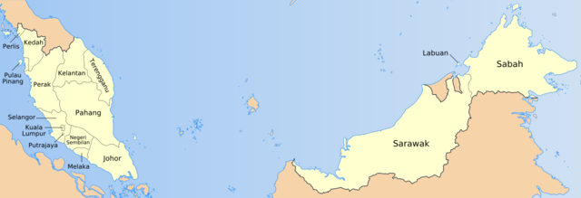
English: Map of the states of Malaysia, named in local terms. |
| 日脚 | |
| 来源 | Originally own work by uploader based on PD CIA material, using other sources to estimate the borders of Putrajaya. This version is based on File:Malaysia location map.svg |
| 作者 | Golbez, Mdzafri |
授权协议
我,本作品著作权人,特此采用以下许可协议发表本作品:

|
已授权复制、传播搭/或修改本文档,依据自由软件基金会发布个GNU自由文档许可证1.2版或任何后续版本个条款;呒不弗可变章节,也呒不封面封底文字。许可证个副本包括勒GNU Free Documentation License章节当中。 |
| 本文件用知识共享“署名-相同方式共享 3.0 未本地化版本”许可协议授权。 | ||
| ||
| 本许可协议标签作为GFDL许可协议更新的组成部分被添加至本文件。 |
侬好选择侬需要个许可协议。
文件历史
揿一个日脚/辰光来望当时出现过个文件。
| 日脚 / 辰光 | 微缩图 | 维度 | 用户 | 备注 | |
|---|---|---|---|---|---|
| 当前 | 2009年7月19号 (日) 18:57 | 1,500 × 513(163 KB) | Mdzafri | Corrected error in Perlis labeling and using a more detailed map. | |
| 2006年1月25号 (三) 08:44 | 1,500 × 513(34 KB) | Golbez | Better location for a couple of names. | ||
| 2006年1月24号 (两) 17:35 | 1,500 × 513(34 KB) | Golbez | Map of the states of Malaysia, named in English/local terms I think. Made by User:Golbez, based on PD CIA material, using other sources to estimate the borders of Putrajaya. Category:Maps of Malaysia |
文件用法
下向许1张用着箇文件:
全域文件用场
下底个其他wiki使用箇只文件:
- ace.wikipedia.org上个用途
- an.wikipedia.org上个用途
- ar.wikipedia.org上个用途
- az.wikipedia.org上个用途
- ban.wikipedia.org上个用途
- bg.wikipedia.org上个用途
- br.wikipedia.org上个用途
- csb.wikipedia.org上个用途
- cs.wikipedia.org上个用途
- da.wikipedia.org上个用途
- diq.wikipedia.org上个用途
- el.wikipedia.org上个用途
- en.wikipedia.org上个用途
- en.wikisource.org上个用途
- eu.wikipedia.org上个用途
- fa.wikipedia.org上个用途
- fi.wikipedia.org上个用途
查看本文件个更多全域用途。