File:Middle East (orthographic projection).svg

此SVG文件的PNG预览的大小:553×553像素。 其他分辨率:240×240像素 | 480×480像素 | 768×768像素 | 1,024×1,024像素 | 2,048×2,048像素。
原始文件 (SVG文件,名义大小:553×553像素,文件大小:328 KB)
小结
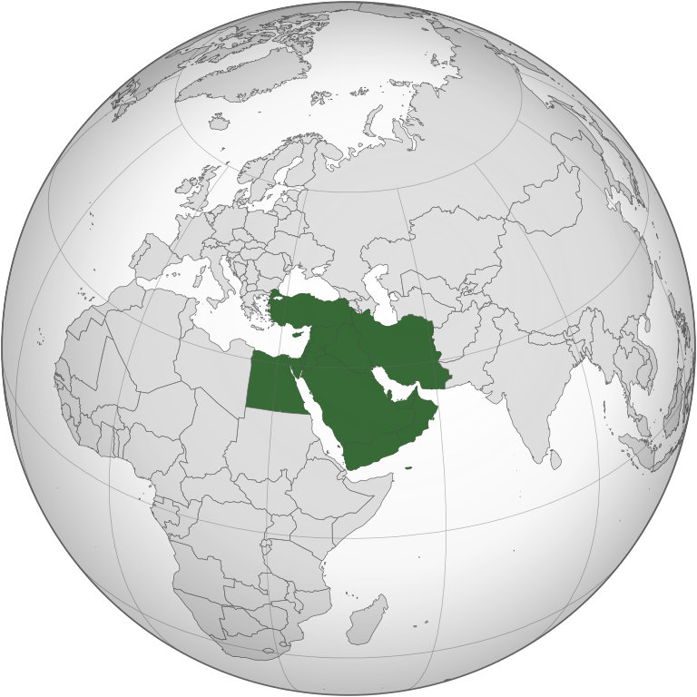
| 描述 | 中東 | ||||
| 日脚 | |||||
| 来源 |
自家个作品 (Original text: Own work,)
|
||||
| 作者 | TownDown | ||||
| 其他版本 |
.svg) |
||||
| SVG开发 |
.svg)
.svg)
.svg)
.svg)
.svg)
.svg)
.svg)
.svg)
.svg)
.svg)
.svg)
.svg)
.svg)
.svg)
.svg)
.svg)
.svg)
.svg)
.svg)
.svg)
.svg)
.svg)
.svg)
.svg)
.svg)
.svg)
.svg)
.svg)
.svg)
.svg)
.svg)
.svg)
.svg)
.svg)
.svg)
.svg)
.svg)
.svg)
.svg)
.svg)
.svg)
.svg)
.svg)
.svg)
.svg)
.svg)
.svg)
.svg)
.svg)
.svg)
.svg)
.svg)
.svg)
.svg)
.svg)
.svg)
.svg)
.svg)
.svg)
.svg)
.svg)
.svg)
.svg)
.svg)
.svg)
.svg)
.svg)
.svg)
.svg)
.svg)
.svg)
.svg)
.svg)

.svg)

.svg)

.svg)
.svg)
.svg)
.svg)
.svg)
.svg)
.svg)


.svg)
.svg)
.svg)
.svg)
.svg)
.svg)
.svg)

.svg)
.svg)
.svg)
.svg)
.svg)
.svg)
.svg)
.svg)
.svg)

.svg)
.svg)
.svg)
.svg)
.svg)
.svg)
.svg)
_without_national_boundaries.svg)
.svg)
.svg)
.svg)
.svg)
.svg)
.svg)

.svg)
.svg)
.png)
.svg)
.svg)
.svg)
.svg)

.svg)
.svg)
.svg)
.svg)
.svg)
.svg)
.svg)
.svg)
.svg)
.svg)
.svg)

.svg)
.svg)
.svg)
.svg)
.svg)
.svg)
.svg)
.svg)
.svg)

.svg)
.svg)

.svg)
.svg)
.svg)
.svg)
.svg)
.svg)
.svg)
.svg)
.svg)
.svg)
.svg)
.svg)
.svg)
.svg)
.svg)
.svg)
.svg)
.svg)
.svg)
.svg)
.svg)
.svg)
.svg)
.svg)
.svg)
.svg)
.svg)
_-_Crimea_disputed.svg)
.svg)
.svg)
.svg)
.svg)
.svg)
.svg)
.svg)
.svg)
.svg)
.svg)
.svg)
_political.svg)
.svg)
.svg)
.svg)
.svg)
_-_Crimea_disputed_-_no_borders.svg)
.svg)
.svg)
.svg)
.svg)
.svg)
.svg)
.svg)
.svg)
.svg)
.svg)
.svg)

.svg)
.svg)
.svg)

.png)
.svg)
.svg)
.svg)
.svg)
.svg)
.svg)
.svg)
.svg)
.svg)
.svg)
.svg)
.svg)
.svg)
.svg)
.svg)
.svg)
.svg)
.svg)
.svg)
.svg)
.svg)
.svg)
.svg)
.svg)
.svg)
.svg)
.svg)
.svg)
.svg)
.svg)
.svg)
.svg)
.svg)
.svg)
.png)
.svg)
.svg)
.svg)
_(orthographic_projection).png)
.svg)
.svg)
.svg)
.svg)
.svg)
授权协议
我,本作品著作权人,特此采用以下许可协议发表本作品:

|
已授权复制、传播搭/或修改本文档,依据自由软件基金会发布个GNU自由文档许可证1.2版或任何后续版本个条款;呒不弗可变章节,也呒不封面封底文字。许可证个副本包括勒GNU Free Documentation License章节当中。 |
| 本文件用知识共享“署名-相同方式共享 3.0 未本地化版本”许可协议授权。 | ||
| ||
| 本许可协议标签作为GFDL许可协议更新的组成部分被添加至本文件。 |
| Annotations | This image is annotated: View the annotations at Commons |
文件历史
揿一个日脚/辰光来望当时出现过个文件。
.svg&dir=prev)
.svg&offset=20210329031415)
.svg&offset=&limit=20)
.svg&offset=&limit=50)
.svg&offset=&limit=100)
.svg&offset=&limit=250)
.svg&offset=&limit=500)
| 日脚 / 辰光 | 微缩图 | 维度 | 用户 | 备注 | |
|---|---|---|---|---|---|
| 当前 | 2023年1月27号 (五) 11:10 | | 553 × 553(328 KB) | Treetoes023 | Reverted to version as of 15:50, 29 April 2021 (UTC): A map of the Middle East with all white borders will be made so this one can stay the same. |
| 2023年1月23号 (一) 01:17 |  | 553 × 553(328 KB) | M.Bitton | highlighted the inner borders, per request. Feel free to revert if you disagree | |
| 2021年4月29号 (四) 23:50 |  | 553 × 553(328 KB) | LightandDark2000 | Reverted to version as of 09:19, 6 April 2021 (UTC) Stop edit-warring. And your your're a [[:User:Mazum24}Mazum24]] sock, you're going to be Globally Locked. | |
| 2021年4月29号 (四) 23:28 |  | 553 × 553(406 KB) | Inkify | Reverted to version as of 07:56, 6 April 2021 (UTC) | |
| 2021年4月6号 (两) 17:19 |  | 553 × 553(328 KB) | Chipmunkdavis | Reverted to version as of 17:15, 17 March 2015 (UTC) Rv to stable image that has roughly been in place for a decade. New definition is far more restrictive than common usage. | |
| 2021年4月6号 (两) 15:56 |  | 553 × 553(406 KB) | GPinkerton | Reverted to version as of 16:16, 3 April 2021 (UTC) See talk page. There are already numerous maps of looser definitions these images should be used for those purposes. Wikipedia's (badly sourced, inaccurate) "Middle East" article should not govern the contents of this page. | |
| 2021年4月6号 (两) 15:41 |  | 553 × 553(328 KB) | Rsk6400 | Reverted to version as of 17:15, 17 March 2015 (UTC) - see COM:OW. Significantly changing this file causes problems, e.g. on en:Middle East | |
| 2021年4月4号 (日) 00:16 |  | 553 × 553(406 KB) | GPinkerton | Reverted to version as of 03:14, 29 March 2021 (UTC) reverting unexplained changes: see talk page | |
| 2021年4月1号 (四) 08:39 |  | 553 × 553(328 KB) | NotAMonarchist | Reverted to version as of 17:15, 17 March 2015 (UTC) | |
| 2021年3月29号 (一) 11:14 |  | 553 × 553(406 KB) | GPinkerton | Less expansive definition, according with the "generally accepted" definition mentioned by the ''Concise Oxford Dictionary of World Place Names'' (6th ed.): "comprising Iraq, Iran, Israel, Jordan, Lebanon, Syria, and the Arabian Peninsula". |
文件用法
下向许1张用着箇文件:
全域文件用场
下底个其他wiki使用箇只文件:
- am.wikipedia.org上个用途
- ar.wikipedia.org上个用途
- الأردن
- لبنان
- سلطنة عمان
- اليمن
- العراق
- قطر
- إسرائيل
- الكويت
- قطاع غزة
- البحرين
- إيران
- قبرص
- تركيا
- قبرص الشمالية
- قالب:الشرق الأوسط
- إقليم كردستان العراق
- إمارة شرق الأردن
- دولة فلسطين
- بوابة:السعودية
- تاريخ الشرق الأوسط
- سوريا
- الشرق الأوسط الكبير
- بوابة:الكويت
- ويكيبيديا:صناديق المستخدم/بلدان
- مصر
- مطبخ الشرق الأوسط
- السعودية
- موسيقى الشرق الأوسط
- قرار مجلس الأمن التابع للأمم المتحدة رقم 425
- بوابة:القدس
- الشرق الأوسط
- الإمارات العربية المتحدة
- فلسطين
- بوابة:تركيا
- التعليم في قبرص الشمالية
- قرار مجلس الأمن التابع للأمم المتحدة رقم 369
- قرار مجلس الأمن التابع للأمم المتحدة رقم 368
- قرار مجلس الأمن التابع للأمم المتحدة رقم 378
- بوابة:البحرين
- بوابة:البحرين/قوالب
- قرار مجلس الأمن التابع للأمم المتحدة رقم 452
- قائمة نزاعات الشرق الأوسط الحديثة
- مستخدم:Avocato/مصر
- منظمة البورصة والأوراق المالية الإيرانية
- مستخدم:Abdullah Yamani/ملعب
- فيروس كورونا المرتبط بمتلازمة الشرق الأوسط التنفسية
- تصنيف:قادة دول الشرق الأوسط
- بوابة:الكويت/قوالب
- بوابة:السعودية/قوالب
查看本文件个更多全域用途。
.svg)
.svg)