File:Sumatra 2007 earthquakes map.gif
无更高分辨率可提供。
Sumatra_2007_earthquakes_map.gif (505×496像素,文件大小:30 KB,MIME类型:image/gif)
小结
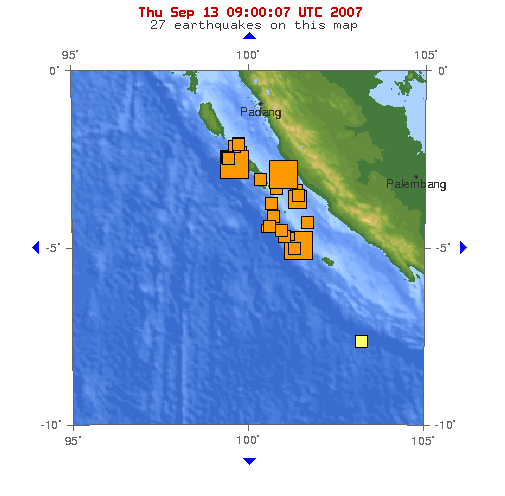
Image: This map shows the location of the 3 major earthquakes and it's many aftershocks off the coast of Sumatra on September 12 and September 13, 2007. It shows a total of 27 earthquakes, 25 of them in the last 24 hours.
Source: https://earthquake.usgs.gov/eqcenter/recenteqsww/Maps/10/100_-5.php (dynamic)
授权协议
|
|
文件历史
揿一个日脚/辰光来望当时出现过个文件。
| 日脚 / 辰光 | 微缩图 | 维度 | 用户 | 备注 | |
|---|---|---|---|---|---|
| 当前 | 2007年9月13号 (四) 17:53 | | 505 × 496(30 KB) | TheDJ | == Summary == '''Image:''' This map shows the location of the 3 major earthquakes and it's many aftershocks off the coast of Sumatra on September 12 and September 13, 2007. It shows a total of 27 earthquakes, 25 of them in the last 24 hours. |
文件用法
下向许1张用着箇文件:
全域文件用场
下底个其他wiki使用箇只文件:
- de.wikipedia.org上个用途
- en.wikipedia.org上个用途
- id.wikipedia.org上个用途
- ja.wikipedia.org上个用途
- zh.wikipedia.org上个用途